Skip to main content
My Favorites
Place An Order
Copyright Statement
Contact
Home
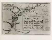
Detroit River (Mich. and Ont.)--Maps--Early works to 1800
Detroit River (Mich. and Ont.)--Maps--Early works to 1800
Favorite this
☆
bh009597
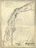
Map of Detroit River from Lake Erie to Lake St. Clair
Favorite this
☆
bh009560
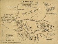
Plan of the Detroit River from Presque Isle to Grosse Ile
Favorite this
☆
bh009559
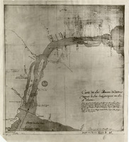
Map of Detroit River from Lake Erie to Lake St. Clair
Favorite this
☆
bh006554
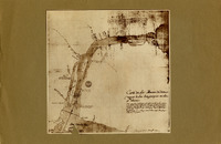
Map of Detroit River from Lake Erie to Lake St. Clair
Favorite this
☆
bh006553
Map of Detroit River from Lake Erie to Lake St. Clair
Subscribe to Detroit River (Mich. and Ont.)--Maps--Early works to 1800