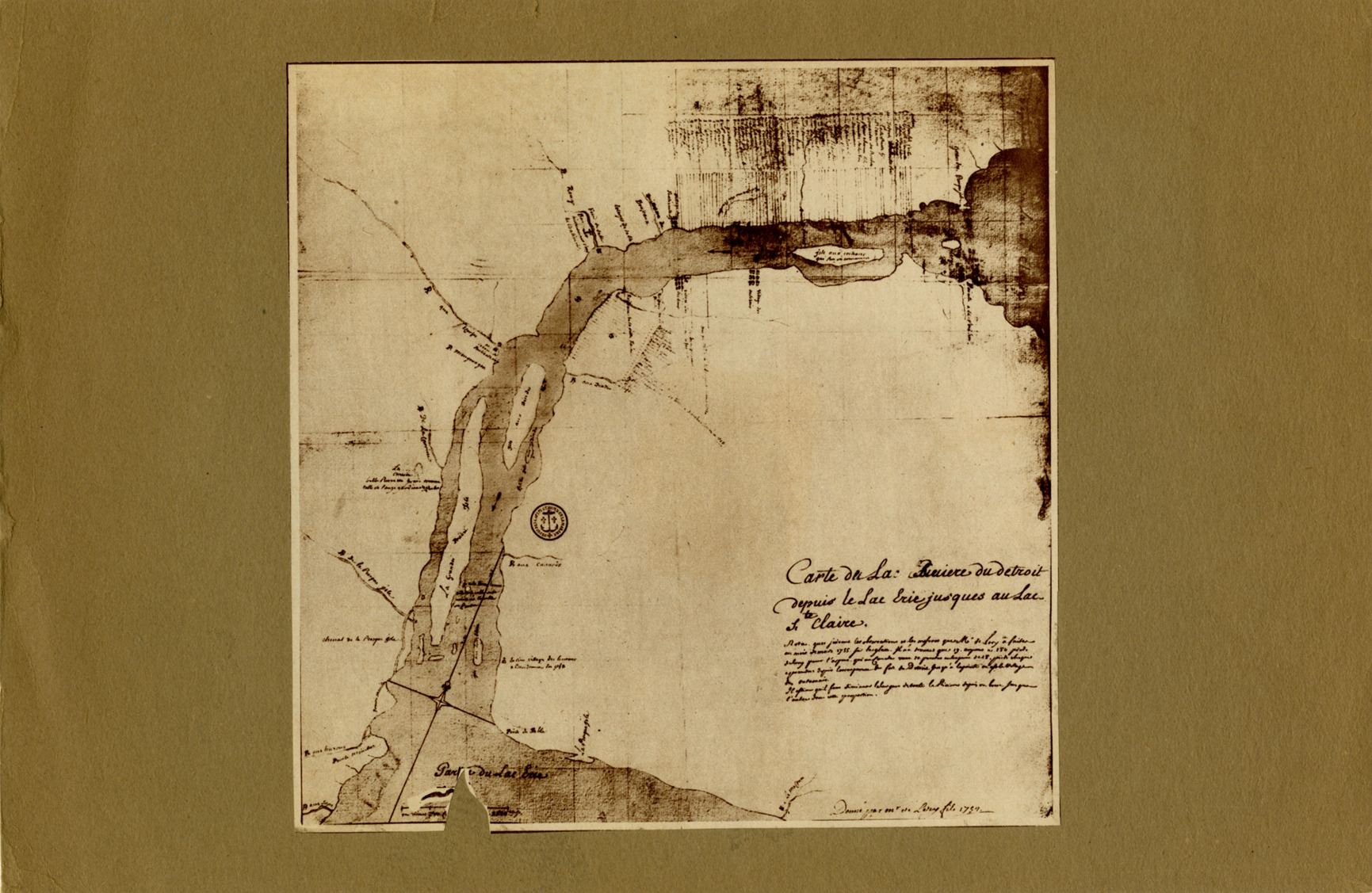
Map of Detroit River from Lake Erie to Lake St. Clair
Description:
Early map depicting Detroit River from Lake Erie to Lake St. Clair. Printed on front: "Carte de la Riviere du Detroit depuis le Lac Erie jus'ques au Lac Ste. Claire." Printed on back: "Map of Detroit in 1755, parallel lines extending from river's edge (at top) are boundaries of the first farms. Population was about 500." Handwritten on back: "From the Detroit Times, July 19, 1931, Sunday gravure section. Lery, de. Carte de la riviere du Detroit."