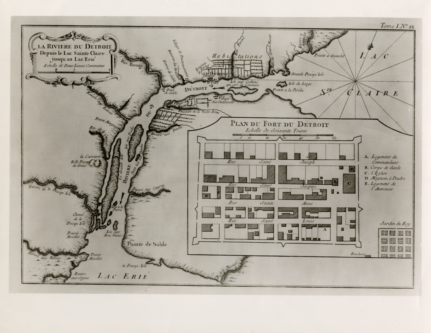
Map of Detroit River from Lake Erie to Lake St. Clair
Description:
Early map depicting Detroit River from Lake Erie to Lake St. Clair with plan of Fort Detroit. Printed on front: "La Riviere du Detroit depuis le Lac Sainte Claire jusqu'au Lac Erie, echelle de deux lieues communes. Plan du Fort du Detroit, echelle de soixante toises."