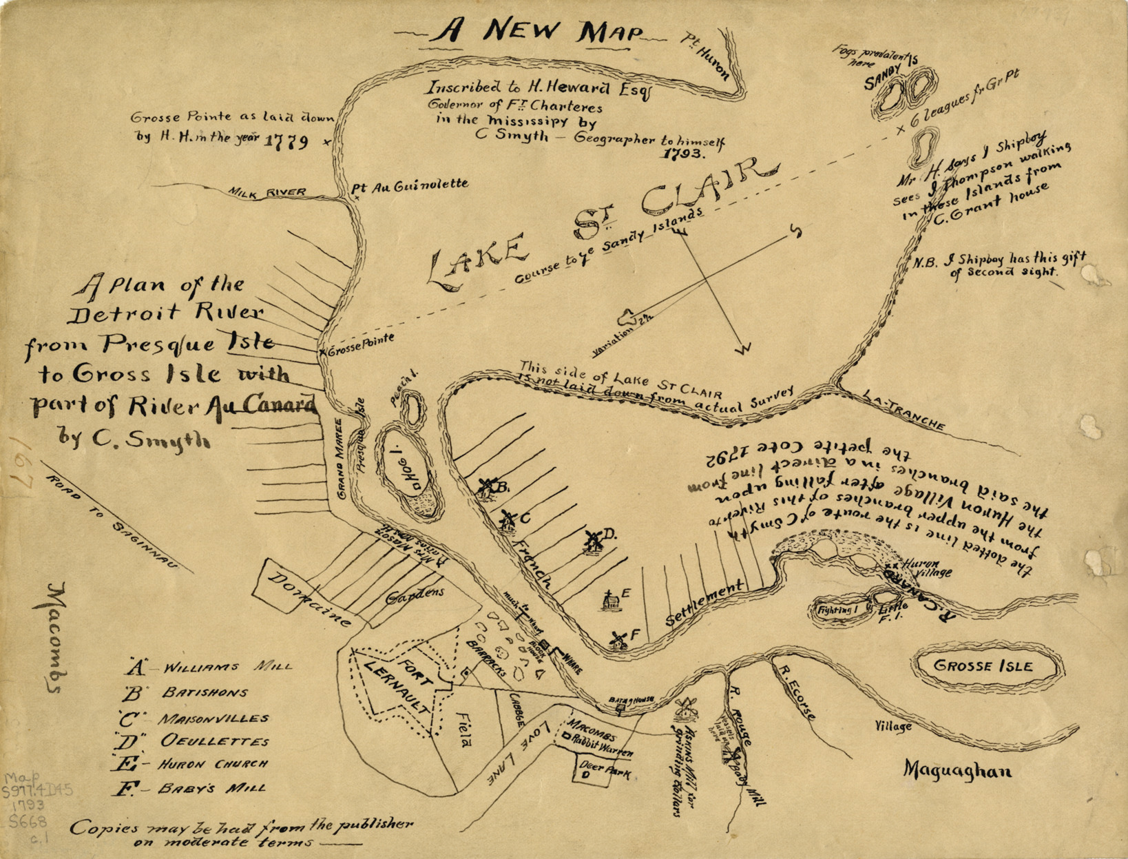
Plan of the Detroit River from Presque Isle to Grosse Ile
Description:
Early map depicting Detroit River from Presque Isle to Grosse Ile. Handwritten on front: "A new map inscribed to H. Heward Esq., Governor of Ft. Charteres in the Mississipy by C. Smyth, geographer to himself, 1793. A plan of the Detroit River from Presque Isle to Gross Isle [sic] with part of River au Canard by C. Smyth."