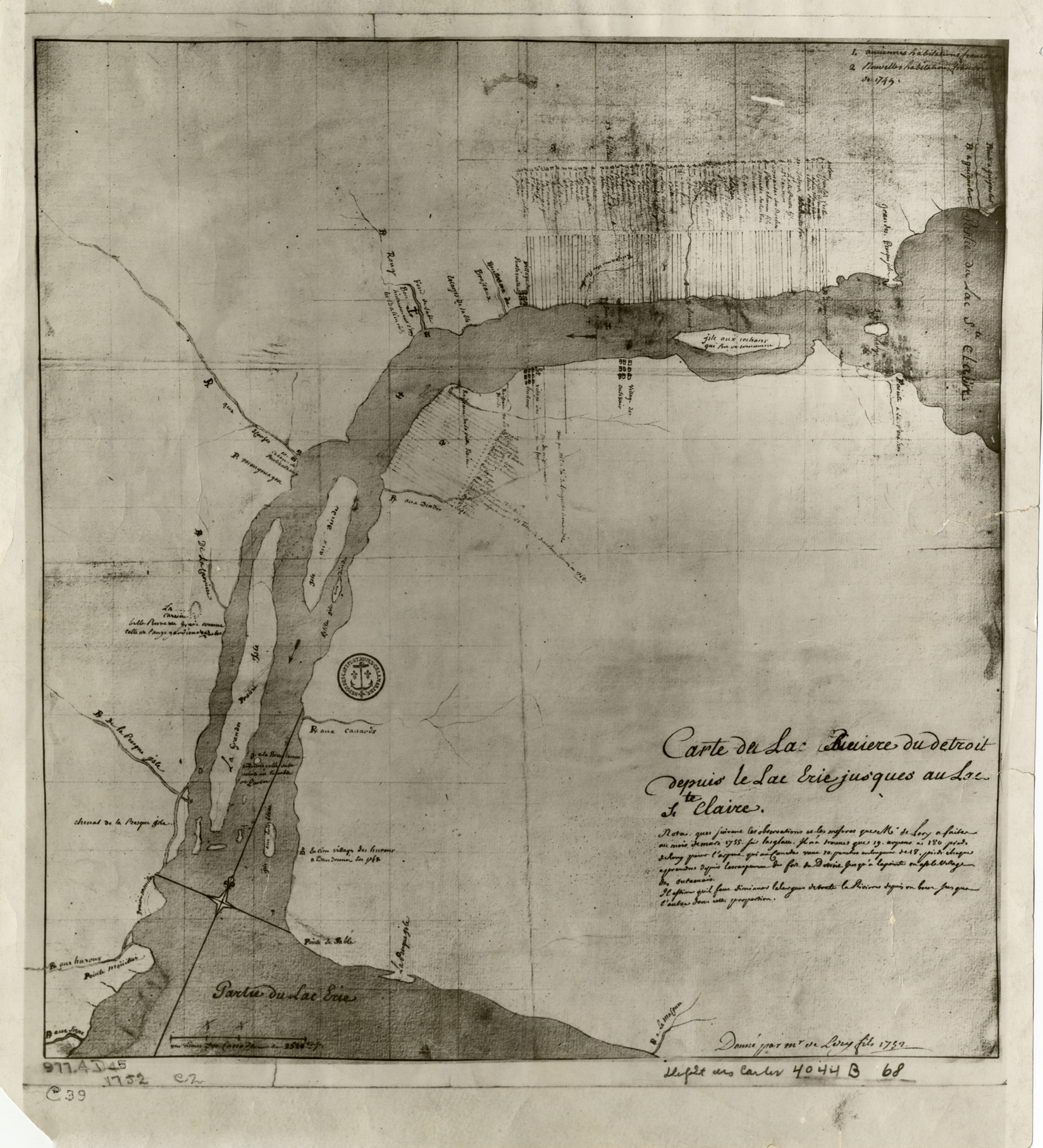
Favorite this☆ Map of Detroit River from Lake Erie to Lake St. Clair Description: Reproduction of early map depicting Detroit River from Lake Erie to Lake St. Clair. Printed on front: "Carte de la Riviere du Detroit depuis le Lac Erie jus'ques au Lac Ste. Claire." Details Resource ID: bh009597 Creator: Chaussegros de Lery, Gaspard-Joseph, 1682-1756 Subject: Detroit River (Mich. and Ont.)--Maps--Early works to 1800 Date Issued: 1752 Format: 1 sheet ; 12 x 11 in. Member of: Burton Historical Collection Filing Location: 977.4 D45 c39 1752 Rights: Physical rights are retained by DPL. Copyright is retained in accordance with U.S. copyright laws.