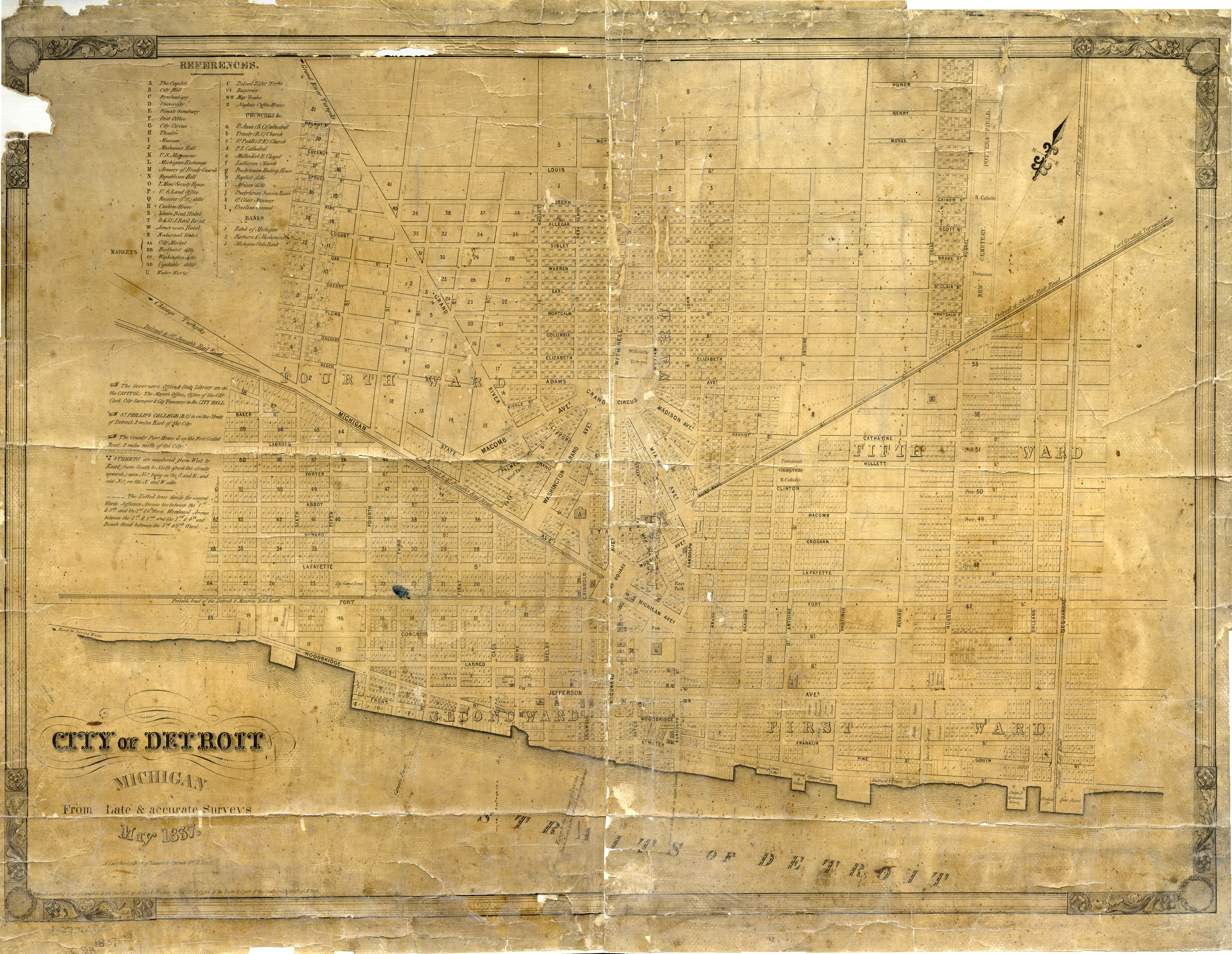
Street map or plan of Detroit, Michigan by Nathaniel Currier dated May, 1837. Printed on front: "City of Detroit, Michigan from late & accurate surveys, May 1837. N. Currier's [undecipherable] cor. of Nassau & Spruce Sts. N. York. Entered according to act of Congress in the year 1837 by Morse & Brother in the Clerk's Office of the District Court of the Southern District of N. York."