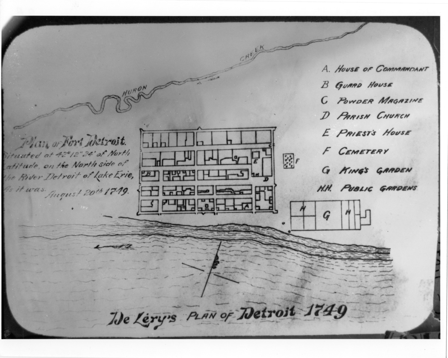
Favorite this☆ Plan of Fort Detroit Description: Plan of Fort Detroit in 1749. Printed on front: "De Lery's plan of Detroit, 1749. Plan of Fort Detroit situated at 42 [degrees], 12" 24' of north latitude on the north side of the River Detroit of Lake Erie as it was, August 20, 1749." Details Resource ID: bh006555 Creator: Chaussegros de Lery, Gaspard-Joseph, 1682-1756 Subject: Fortification--Michigan--Detroit--Designs and plans Fort Detroit (Detroit, Mich.) Photographic prints Date Issued: 1749-08-20 Format: 1 photographic print ; 8 x 10 in. Member of: Burton Historical Collection Filing Location: D/Forts-Detroit, 1749 Rights: Physical rights are retained by DPL. Copyright is retained in accordance with U.S. copyright laws.