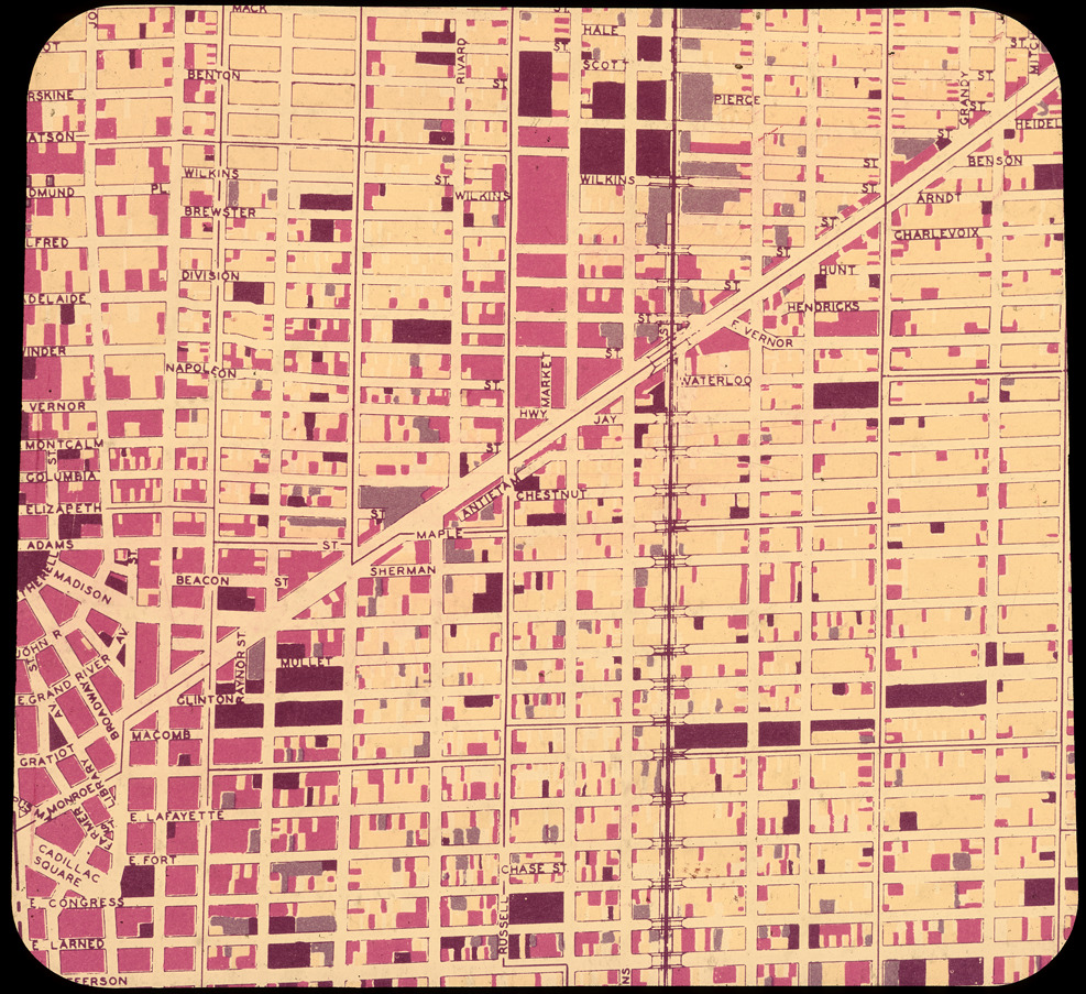
Street map of Detroit showing Gratiot Avenue and cross streets. Label on mount: "This land is being badly used now, with no direction or purpose for people or industry. Red represents commercial business, blue is industry, yellow residential and black all other uses. See how jumbled it is today." Printed on mount: "A visual cast presentation prepared by Henning & Cheadle, Inc., 1060 W. Fort St., Detroit, Woodward 1-7688."