Image
Map of United States, Central America and South America
Description:
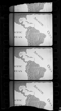
Topographic map of southern United States, Central America and South America. Printed on image: "Atlantic Ocea[n], [P]acific [O]cean." Handwritten on sleeve: "View of USA and Central America, Panama Canal between, 1931."
Details
Resource ID:
na031988
Date Issued:
1931
Format:
1 negative ; 2.5 x 1.5 in.
Filing Location:
MS33/Aloha Baker collection, Box 7, Folder 1, America: North, Negative Book, U.S.A., 1914-1932
Negative Number:
NAM-003
Rights:
Physical rights are retained by DPL. Copyright is retained in accordance with U.S. copyright laws.