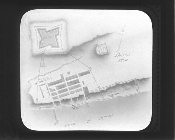
Favorite this☆ Map of Fort Leroult, Detroit, Michigan from 1780 Description: Image of a map of Fort Leroult, Detroit, Michigan from 1780, showing the fortification and the Detroit River. Recorded in lantern slide ledger: "D/Maps-Fort Leroult, c.1780." Details Resource ID: EB02c425 Subject: Detroit (Mich.)--Maps Detroit River (Mich. and Ont.)--Maps Fortification--Michigan--Detroit Lantern slides Date Issued: Unknown year Format: 1 transparency : glass ; 3.25 x 4 in. Member of: Burton Historical Collection Negative Number: BHC lantern slide no. 255 Rights: Physical rights are retained by DPL. Copyright is retained in accordance with U.S. copyright laws.