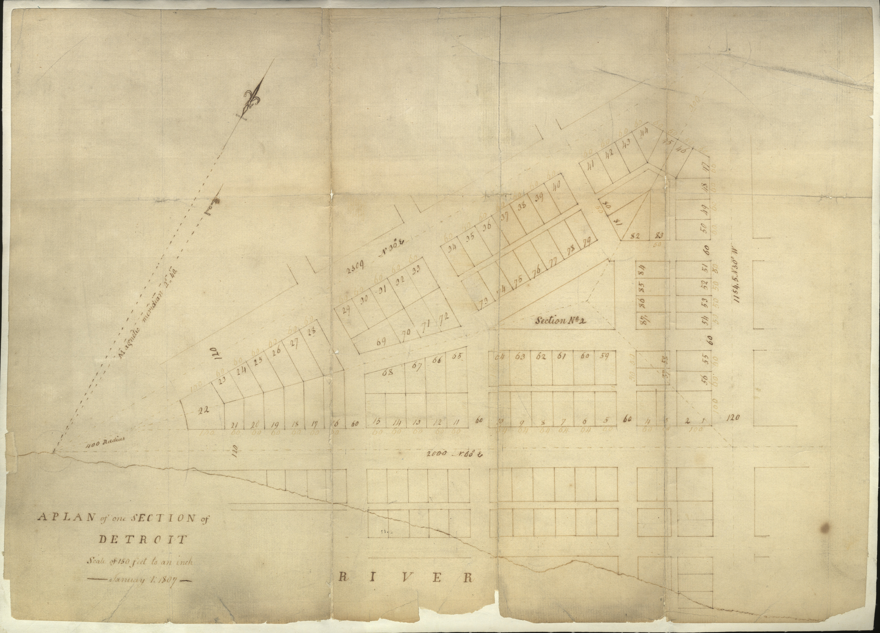
Map or plan of Detroit, Michigan dated January 1, 1807 by Abijah Hull. Map was probably drawn by December 12, 1806. This example of a section was probably enclosed with the plan of the city of Detroit in the governor and judges' letter to Congress of December 12, 1806. (Dunnigan, 2001) Printed on front: "A plan of one section of Detroit. Scale of 150 feet to an inch. January 1, 1807."