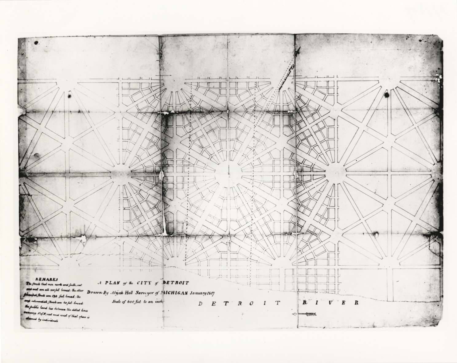
Favorite this☆ Plan of Detroit, 1807 Description: Plan of Detroit, showing layout of streets. Printed on front: "A plan of the city of Detroit. Drawn by Abijah Hull, surveyor of Michigan, January, 1807. Scale of 600 feet to an inch." Details Resource ID: bh006561 Creator: Hull, Abijah Subject: Detroit (Mich.)--Maps City planning--Michigan--Detroit Photographic prints Date Issued: 1807-01 Format: 1 photographic print ; 8 x 10 in. Member of: Burton Historical Collection Filing Location: D/1807 Rights: Physical rights are retained by DPL. Copyright is retained in accordance with U.S. copyright laws.