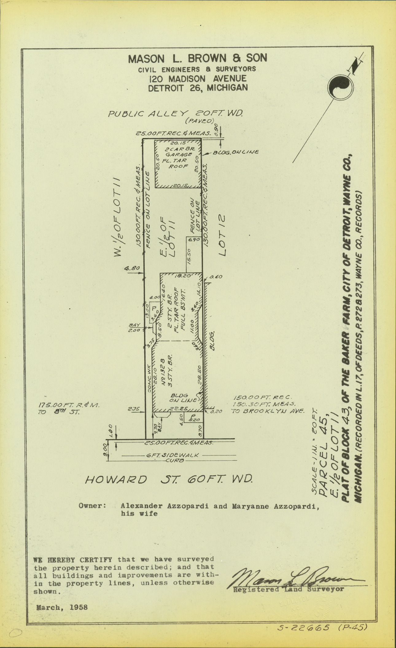
Plat map for property located on Howard, parcel 45, E. 1/2 of lot 11. Recorded on map: "Plat of block 43, of the Baker Farm, city of Detroit, Wayne Co., Michigan. (Recorded in L. 17, of deeds, P. 272 & 273, Wayne Co., records.) Mason L. Brown & Son, civil engineers & surveyors, 120 Madison Avenue, Detroit 26, Michigan. We hereby certify that we have surveyed the property herein described; and that all buildings and improvements are within the property lines, unless otherwise shown, [signed] Mason L. Brown, registered land surveyor."
MS/Detroit. Corporation Counsel. Real Estate Div., Box 22
Note (Content):
Part of a collection that contains condemnation files, photographs, blueprints and descriptions of slum clearance housing parcels for the City of Detroit. Of particular note are areas which included the neighborhoods known as Paradise Valley, Black Bottom, Corktown and the Jeffries Housing Project.
Rights:
Physical rights are retained by DPL. Copyright is retained in accordance with U.S. copyright laws.